The 20 best hiking spots in France
France offers a multitude of hiking trails, each revealing varied and enchanting landscapes. From Mediterranean coasts to Alpine peaks and Breton forests, each route promises a unique experience for nature lovers.
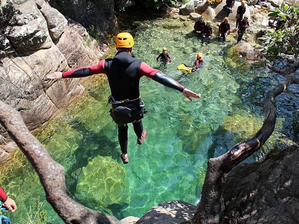
The Calanques of Marseille/Cassis
This coastal trail winds between limestone cliffs and turquoise coves, offering breathtaking panoramas. The wealth of Mediterranean flora and fauna makes it a must for hikers.
The hike covers around 6.8 km, with a positive difference in altitude of 239 metres, and is usually completed in 4 hours. Accessible to children aged 12 and over, it is classified as intermediate difficulty. The fee is €40 per adult and €30 per child.
📍 Location: Bouches-du-Rhône, Provence-Alpes-Côte d'Azur
👣 Distance: 6.8 km
⏳ Duration: 4 hours
🥾 Difference in altitude: 239 m
💪 Difficulty: Intermediate
👉 Book online
Lac de Serre-Ponçon
Nestled in the heart of the Southern Alps, this hike offers panoramic views of Lac de Serre-Ponçon, surrounded by majestic mountains. The trails pass through forests and alpine meadows, offering total immersion in nature.
There are two options for hikers: a 3-hour half-day hike with a maximum vertical drop of 300 meters, ideal for families and beginners, or a 7-hour full-day hike for the more adventurous. Rates range from €40 to €50 depending on duration.
📍 Location: Hautes-Alpes, Provence-Alpes-Côte d'Azur
👣 Distance: Varies according to itinerary
⏳ Duration: 3 or 7 hours
🥾 Difference in altitude: Up to 300 m
💪 Difficulty: Easy to moderate
👉 Book online
Mont Caly
Located in Haute-Savoie, Mont Caly offers breathtaking views of the Mont-Blanc massif. Trails wind through lush green pastures and alpine forests, offering a peaceful experience away from the hustle and bustle of tourism.
The cani-rando is accessible to all levels, with itineraries to suit all abilities. Duration varies between 2 and 4 hours, with a moderate gradient. Access is free, making it an economical option for a nature getaway.
📍 Location: Haute-Savoie, Auvergne-Rhône-Alpes
👣 Distance: Approx. 8 km
⏳ Duration: 2 to 4 hours
🥾 Difference in altitude: approx. 400 m
💪 Difficulty: Easy to moderate
👉 Online booking
Monts d'Arrée
At an altitude of 385 meters, the Monts d'Arrée are the summit of Brittany. Their wild moors and rocky ridges create a unique atmosphere. With Funbooker, go hiking with dogs and explore the Saint-Michel de Braspart chapel, Roc'h Cléguer and the lakes of Brennilis and Drennec.
The well-marked trails allow hikes of 3 to 5 hours, with a moderate gradient. Access is free, and the area is also rich in Celtic legends, adding a cultural dimension to the experience.
📍 Location: Finistère, Brittany
👣 Distance: Approx. 12 km
⏳ Duration: 3 to 5 hours
🥾 Difference in altitude: approx. 300 m
💪 Difficulty: Moderate
👉 Online booking
Thiézac
In the heart of the Cantal region, Thiézac offers a unique hike blending volcanic landscapes and winding rivers. The route is ideal for lovers of wilderness and grandiose panoramas.
The hike lasts around 4 hours, with a 250-meter vertical drop. It is accessible to intermediate hikers and allows you to explore some amazing rock formations. Access is free, perfect for an unrestricted nature outing.
📍 Location: Cantal, Auvergne-Rhône-Alpes
👣 Distance: 6 km
⏳ Duration: 4 hours
🥾 Difference in altitude: 250 m
💪 Difficulty: Intermediate
👉 Online booking
La Tournette
This iconic hike around Annecy takes you to the summit of La Tournette, offering exceptional panoramic views of the lake and surrounding massifs. The route alternates between forest paths, mountain pastures and more technical sections, sometimes requiring the use of cables and ladders.
The hike is around 11 km long, with an ascent of 1,200 m, and takes around 6 hours round trip. Of advanced difficulty, it requires good physical condition. Access is free, but it's advisable to set off early to avoid the crowds.
📍 Location: Haute-Savoie, Auvergne-Rhône-Alpes
👣 Distance: 11 km
⏳ Duration: 6 hours
🥾 Difference in altitude: 1,200 m
💪 Difficulty: Difficult
The Hohneck
Located in the Vosges mountains, the Hohneck is the third highest peak in the massif. This hike allows you to explore a variety of landscapes, between forests, rocky ridges and vast meadows, while enjoying breathtaking views over the Alsace plain.
The route is around 10 km long, with a 500 m vertical drop, and can be completed in 4 hours. Intermediate level, it's suitable for the whole family. In winter, it's also popular for snowshoeing and ski touring.
📍 Location: Vosges, Grand Est
👣 Distance: 10 km
⏳ Duration: 4 hours
🥾 Difference in altitude: 500 m
💪 Difficulty: Intermediate
Mont Ventoux
Known as one of the Tour de France's mythical peaks, Mont Ventoux is also a popular destination for hikers. From its arid, rocky slopes, the views over Provence, the Alps and sometimes the Mediterranean Sea are spectacular.
The hike from Bédoin covers around 15 km with a positive altitude difference of 1,600 meters, requiring around 6 to 7 hours' walking. The climb is demanding, but the effort is amply rewarded by the grandiose scenery.
📍 Location: Vaucluse, Provence-Alpes-Côte d'Azur
👣 Distance: 15 km
⏳ Duration: 6 to 7 hours
🥾 Difference in altitude: 1,600 m
💪 Difficulty: Difficult
Puy de Sancy
The highest point in the Massif Central, Puy de Sancy offers an exceptional hike through lush, volcanic landscapes. The ascent follows well-maintained paths and allows you toadmire the surroundingridges and valleys.
The hike is around 8 km long, with a 600 m vertical drop, and can be completed in 4 hours. A cable car is available to reduce the effort. The climb up the summit stairs offers an original touch to the ascent.
📍 Location: Puy-de-Dôme, Auvergne-Rhône-Alpes
👣 Distance: 8 km
⏳ Duration: 4 hours
🥾 Difference in altitude: 600 m
💪 Difficulty: Intermediate
Lac d'Oô
A true jewel of the Pyrenees, Lac d'Oô is one of France's most beautiful mountain lakes. Nestled at an altitude of 1,500 meters, it can be reached via an easy, well-marked trail through a forest of beech and fir trees.
The hike takes 2 hours and covers a 6 km round trip, with a 400 m vertical drop. Accessible to all, it's ideal for a family outing. At the finish, a superb 275-meter waterfall cascades into the lake.
📍 Location: Haute-Garonne, Occitanie
👣 Distance: 6 km
⏳ Duration: 2 hours
🥾 Difference in altitude: 400 m
💪 Difficulty: Easy
La Rhune
Located in the heart of the Basque Country, La Rhune is an iconic peak offering 360° panoramas of the Atlantic Ocean and the Pyrenees. The ascent takes you through a varied landscape of forests, moors and pastures grazed by the famous Pottoks, wild Basque ponies.
The trail from Ascain stretches for around 9.8 km round trip, with a positive difference in altitude of 780 metres. The ascent takes between 1h30 and 2h30, depending on your pace, and the descent around 2h. The route is of medium to difficult difficulty, recommended for hikers in good physical condition.
📍 Location: Ascain, Pyrénées-Atlantiques, Nouvelle-Aquitaine
👣 Distance: 9.8 km (round trip)
⏳ Duration: 3h30 to 4h30
🥾 Difference in altitude: 780 m
💪 Difficulty: medium to difficult
Les Gorges d'Apremont
Nestled in the heart of the Fontainebleau forest, the Gorges d'Apremont offer a unique landscape of rocky chaos, sand and pine trees. The site has inspired numerous painters and is ideal for an immersion in nature.
The Gorges d'Apremont circuit is a 6.5 km loop with a positive vertical drop of 130 meters. The hike lasts around 3 hours and is rated intermediate in difficulty. The trail is marked in blue and passes through areas sensitive to erosion, so it's essential to stay on the marked paths.
📍 Location: Forêt de Fontainebleau, Seine-et-Marne, Île-de-France
👣 Distance: 6.5 km
⏳ Duration: 3 hours
🥾 Difference in altitude: 130 m
💪 Difficulty: Intermediate
Puy-de-Dôme
A symbol of the Auvergne region, Puy-de-Dôme is a dormant volcano offering panoramic views of the Chaîne des Puys. Its summit is home to a temple to Mercury dating back to Gallo-Roman times, adding a historical dimension to the hike.
The ascent via the sentier des Muletiers is a 6.3 km round trip, with a 350 m vertical drop. The ascent takes around 1h30, the descent 1h. The route is of medium difficulty and offers exceptional panoramas along the way.
📍 Location: Orcines, Puy-de-Dôme, Auvergne-Rhône-Alpes
👣 Distance: 6.3 km (round trip)
⏳ Duration: 2h30
🥾 Difference in altitude: 350 m
💪 Difficulty: Medium
Lac Blanc
Located in the Aiguilles Rouges massif, Lac Blanc is renowned for its crystal-clear waters reflecting the surrounding peaks, including Mont Blanc. The hike offers breathtaking Alpine panoramas and an immersion in Alpine flora.
From the Flégère cable car, the route to Lac Blanc is a 6 km loop with a 500 m vertical drop. The hike takes around 4 hours and is of moderate difficulty. It's possible to extend the itinerary by setting off from the Col des Montets for a sportier experience.
📍 Location: Chamonix-Mont-Blanc, Haute-Savoie, Auvergne-Rhône-Alpes
👣 Distance: 6 km
⏳ Duration: 4 hours
🥾 Difference in altitude: 500 m
💪 Difficulty: Moderate
Tour du Mont Blanc
The Tour du Mont Blanc isone of Europe's most famous treks, crossing France, Italy and Switzerland. It offers a diversity of Alpine landscapes, from verdant valleys to steep passes and picturesque villages.
The entire route covers some 170 km, with a total vertical drop of 10,000 meters. The average duration of the entire trek is 7 to 10 days, with several refuges available along the way. A shorter, more accessible version is also possible.
📍 Location: France, Switzerland, Italy
👣 Distance: 170 km
⏳ Duration: 7 to 10 days
🥾 Difference in altitude: 10,000 m
💪 Difficulty: Difficult
Douaniers Trail (GR34)
The Sentier des Douaniers, or GR34, runs along more than 2,000 km of Brittany's coastline, offering exceptional maritime panoramas. This historic trail takes in cliffs, beaches and picturesque villages.
The entire route covers some 2,000 km, but can be divided into several stages to suit all levels. Total duration varies according to the sections chosen, and the gradient is generally low, making the trail accessible to most hikers.
📍 Location: Brittany, France
👣 Distance: Varies according to section
⏳ Duration: Varies according to section
🥾Elevation gain: Low
💪 Difficulty: Easy to moderate
Vens Lakes
Located in the Mercantour National Park, the Lacs de Vens offer a spectacular alpine landscape with a series of tiered lakes surrounded by majestic peaks. The hike passes through forests and alpine pastures, offering total immersion in nature.
From the hamlet of Le Pra, the route is approximately 15.68 km round trip, with a positive vertical drop of 1,061 meters. The average duration is 7 h 30, and the trail is classified as difficult, requiring good physical condition.
📍 Location: Saint-Étienne-de-Tinée, Alpes-Maritimes, Provence-Alpes-Côte d'Azur
👣 Distance: 15.68 km
⏳ Duration: 7 h 30
🥾 Difference in altitude: 1,061 m
💪 Difficulty: Difficult
Cirque de Gavarnie
A UNESCO World Heritage Site, the Cirque de Gavarnie is a natural wonder of the Pyrenees, with its high cliffs and great waterfall. The hike offers breathtaking views of this majestic site.
From the village of Gavarnie, the route to the cirque is around 10 km round trip, with a 400 m vertical drop. The average duration is 3 h 30, and the trail is accessible to all levels of hiker.
📍 Location: Gavarnie, Hautes-Pyrénées, Occitanie
👣 Distance: 10 km
⏳ Duration: 3 h 30
🥾 Difference in altitude: 400 m
💪 Difficulty: Easy
The Stevenson Trail (GR70)
The Chemin de Stevenson, or GR70, retraces the route of Scottish writer Robert Louis Stevenson through the Cévennes. This hike immerses you in a variety of landscapes, from mountains to verdant valleys.
The entire route covers some 252 km, with a total vertical drop of 6,500 meters. The average duration is 12 days, and the trail is classified as of moderate difficulty, suitable for regular hikers.
📍 Location: From Puy-en-Velay (Haute-Loire) to Alès (Gard), France
👣 Distance: 252 km
⏳ Duration: 12 days
🥾 Difference in altitude: 6,500 m
💪 Difficulty: Moderate
GR20
The GR20 is a long-distance hiking trail crossing Corsica from north to south. Renowned for its difficulty, it offers spectacular mountain scenery and an unforgettable experience for seasoned hikers.
The entire route covers some 180 km, with a total vertical drop of 12,000 meters. The average duration is 16 days, and the trail is rated very difficult, requiring excellent physical condition and good mountain experience.
📍 Location: Corsica, France
👣 Distance: 180 km
⏳ Duration: 16 days
🥾 Difference in altitude: 12,000 m
💪 Difficulty: Very difficult

")
")
")
")
")
")
")
")
")
")
")

")


")
")


 hike-recall trail")
")
")
")
")


")